Research News
Advances in Understanding of Wetland Methane Production and Emissions
Environmental Sciences professor Jorge Villa and his team collaborated on two high-impact studies to advance our understanding of methane production and emissions from wetlands and how we represent these processes in Earth Systems Modeling. Methane is a potent greenhouse gas thought to be responsible for about half of the total global warming effect since preindustrial levels. Despite wetlands representing nearly one-third of global emissions, we still have many questions about how these ecosystems will respond to climate change.
The first study Metabolic interactions underpinning high methane fluxes across terrestrial freshwater wetlands, which appeared in Nature Communications, was lead by a microbiologist team based in Colorado State University, with whom Dr. Villa has worked since 2018. This study revealed that high methane-emitting wetlands exhibit distinct microbial community structures and metabolic interactions that drive methane fluxes. One of the eight core methane cycling genera identified is the Methanoregula, which seems to play a central role as a hub methanogen in microbial networks and is a strong predictor of methane flux. The study also highlights the previously under appreciated fact that methylotrophic methanogenesis is an important pathway contributing to methane production in these ecosystems. These findings present a clearer picture of the specific organisms involved in methane production in wetlands, opening a path for more detailed model representations and hopefully more accurate predictions of methane emissions in climate models.
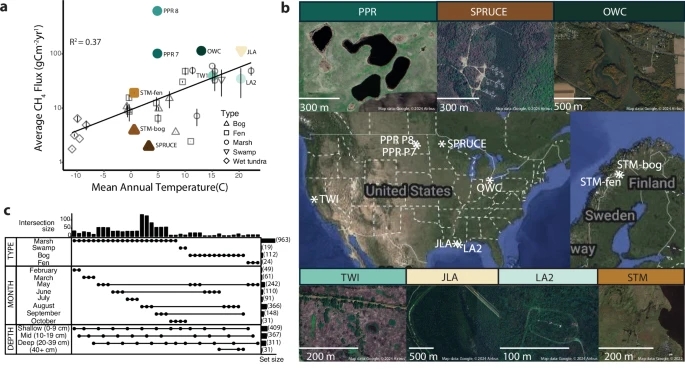
Figure caption: Freshwater wetlands were examined to determine linkages between microbial communities and predictions of methane flux
The other study ELM-Wet: Inclusion of a Wet-Landunit With Sub-Grid Representation of Eco-Hydrological Patches and Hydrological Forcing Improves Methane Emission Estimations in the E3SM Land Model (ELM), which appeared in the Journal of Advances in Modeling Earth Systems (JAMES), was led by researchers at Ohio State University. This study introduced a new, improved version of the land surface representation in the Energy Exascale Earth System Model (E3SM). E3SM is a state-of-the-art model development and simulation project that investigates energy-relevant science using code optimized for the Department of Energy's advanced computers. This model integrates models of the atmosphere, land, river, ocean, sea ice, and land ice to simulate and project climate changes over decades to centuries. E3SM is designed to address energy-related science challenges, such as water availability, extreme temperatures, energy resource potentials, and sea-level rise. Dr. Villa's work generated critical data that was used to parameterize a newly created version of the land component of ELM that includes wetland-specific processes driven by fluctuations in water levels.

Figure caption: Wet-landunit sub-grid representation. Each column represents a different wetland patch type (WPT) (from 1 to nWPT arbitrary eco-hydrological patch types), where each column has a different water depth adapted to the corresponding WPT
This work, which started in 2020, involved Earth and Energy Sciences PhD students, Robert Bordelon and Diana Taj, and sixteen undergraduate research interns trained in greenhouse gas flux measurements and data analyses. The Environmental Science undergraduate student interns are: Eriell Jenkins, Aaron Gondran, Madeline Moore, Monique Blanchard, Victoria Gomez, Jordan Schouest, Jude Digilormo, Mia Rinaudo, Monique Blanchard, Jordan Stoll, Luke Romero , Benjamin Hymel, Jillian Mina, Mason Marcantel, Théo Huval, and Jacob Deslattes.

Greenhouse Gas Flux Measurement Chamber (Wetland Ecosystem Science Lab photo)
Assessment of Phytoplankton Community Composition and Carbon Dynamics in the Wetland-Estuarine Systems of the northern Gulf of Mexico
Bingqing Liu of our School of Geosciences and her collaborators Melissa M.Baustian (USGS) and Eurico J. D'Sa (LSU) have received a $600,000 NASA Earth Surface Mineral Dust Source Investigation (EMIT) research grant. The title of their research project is Exploring the Potential of Hyperspectral EMIT data to Assess Phytoplankton Community Composition and Carbon Dynamics in the Wetland-Estuarine Systems of the northern Gulf of Mexico.
Hyperspectral observation by the Earth Surface Mineral Dust Source Investigation (EMIT) instrument offers an untapped potential for monitoring water quality and biodiversity across diverse habitats, from estuaries and wetlands to coastal pelagic. Before we discuss the current research project we will provide a bit of background.
The EMIT instrument is an imaging spectrometer — a NASA invention widely used in the agency’s space missions — that will measure light in visible and infrared wavelengths. When the various wavelengths of light – the spectrum – are distributed across the instrument’s detector, they display unique spectral signatures indicating the mineral composition of the surface. EMIT will acquire over 100,000 such spectra every second, mapping the composition of minerals on Earth’s surface. EMIT was launched with a SpaceX rocket to its destination on the International Space Station.
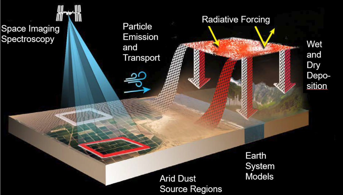
Mineral dust blown into the air is an important part of the Earth system. Wind blows dust into the atmosphere from desert regions around the world, and can carry dust across oceans. Dark minerals that absorb sunlight can warm the Earth, while light-colored minerals can cool the Earth. By accurately mapping the composition of areas that produce mineral dust, EMIT will advance our understanding of dust’s effects throughout the Earth system and to human populations now and in the future.
The purpose of this research project is to explore EMIT hyperspectral capabilities in studying biogeochemical processes in the wetland-estuarine system of the northern Gulf of Mexico, which has experienced rapid changes due to multiple, pressing environmental stressors.
In particular, an advanced machine learning algorithm (mixture density networks) will be tested and a prior adaptive semi-analytical algorithm will be refined to fully utilize the hyperspectral information from EMIT Level 2 surface reflectance data to infer the inherent optical properties and biogeochemical indicators including chlorophyll a, phytoplankton community composition, and dissolved and particulate organic carbon. The EMIT algorithms will be developed and validated using a comprehensive optical and biogeochemical dataset to be acquired through simulation, uncrewed autonomous observation and lab analysis.
This research will directly address the application of EMIT data to advance our understanding of the carbon cycle, ecosystems, biodiversity, and extreme weather events. The proposed algorithms will not only extend the application of EMIT to coastal aquatic environment but also can be spectrally adapted to other current and upcoming hyperspectral missions, including PRISMA (Hyperspectral Precursor of the Application mission), DESIS (DLR Earth Sensing Imaging Spectrometer), SBG (Surface Biology and Geology mission), and PACE (Plankton, Aerosol, Clouds, and ocean Ecosystem mission). The proposed data collection using the autonomous optical system (AOS) will significantly enhance and expand the validation strategies, techniques, and data products of EMIT. Furthermore, this research aligns with one of the key potential applications of the EMIT mission, which is to monitor phytoplankton distribution, as well as harmful algal bloom biomass and composition. In addition, this research will contribute to the development of the Surface Biology and Geology (SBG) mission in area of surface biology and functional traits of inland and near-coastal aquatic ecosystems. The proposed work also closely aligns with the interests of NASA's Earth Science Division's Ocean Biology and Biogeochemistry program, which aims to understand, and predict the biological and biogeochemical processes in the upper ocean through ocean color remote sensing. The proposed algorithms have a mechanistic nature, which enables their seamless adaptation to NASA's next-generation ocean color sensor, such as the hyperspectral PACE (Plankton, Aerosol, Cloud, ocean Ecosystem) mission.
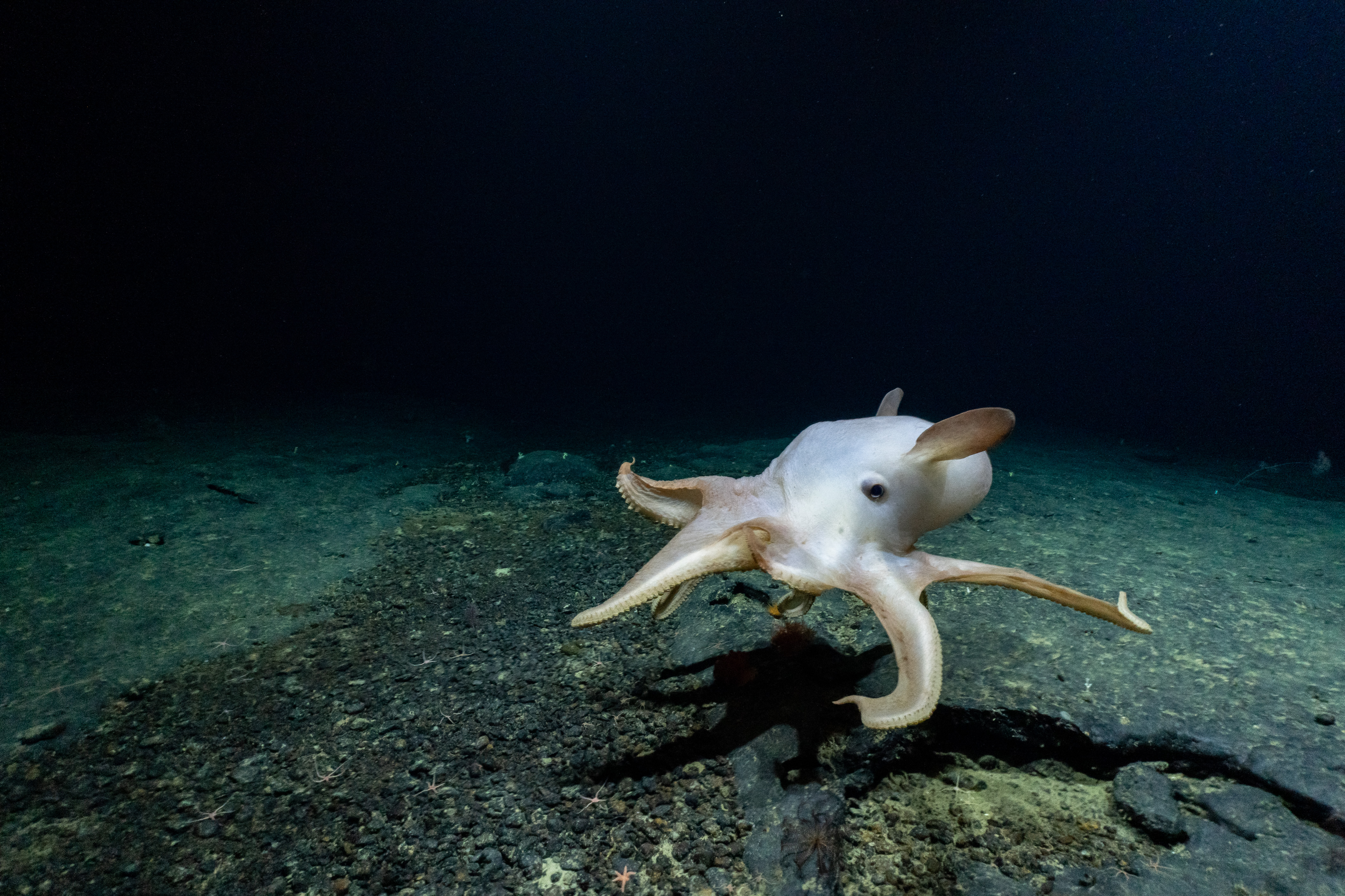
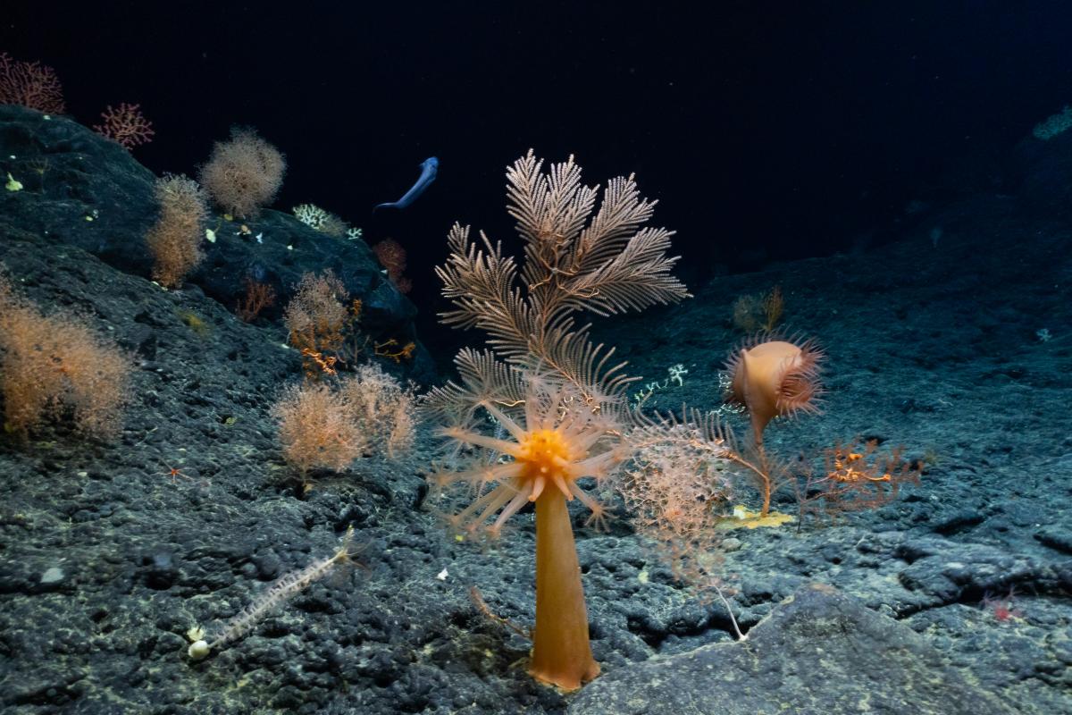
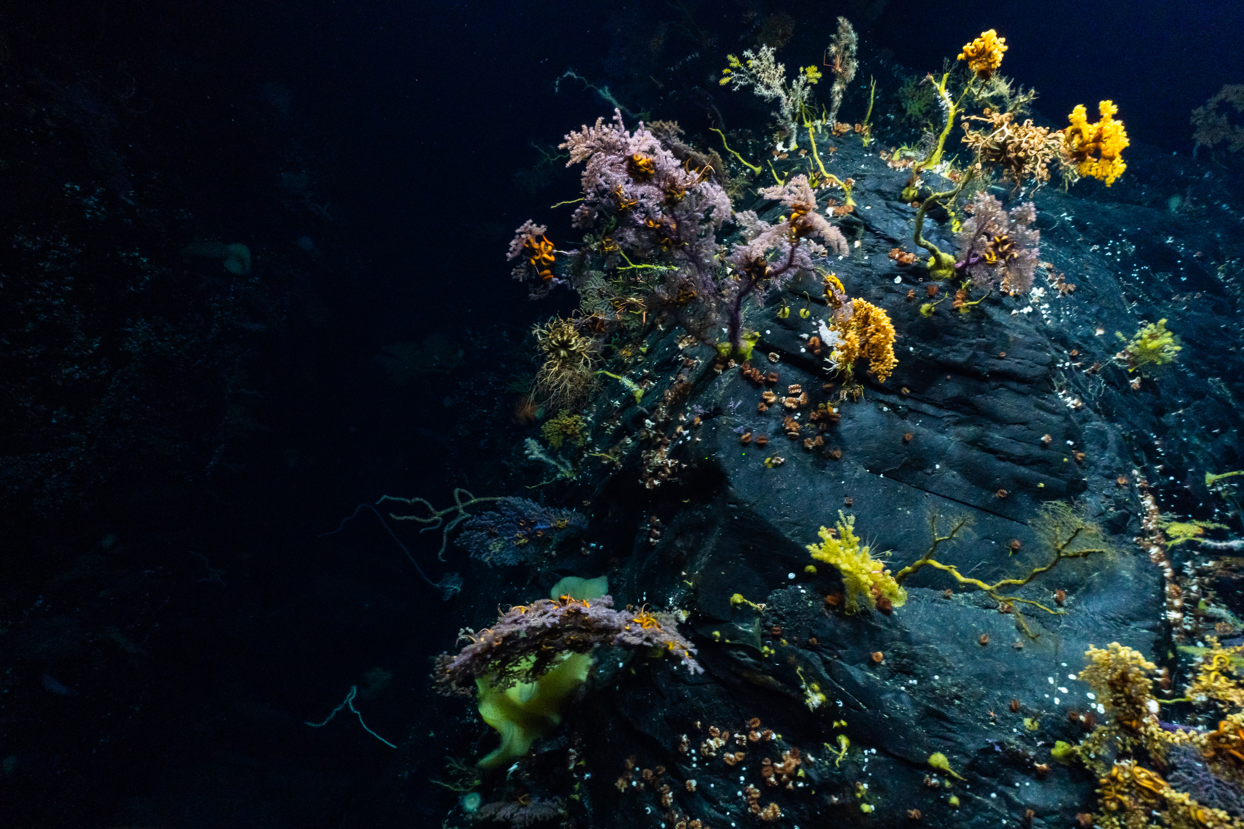
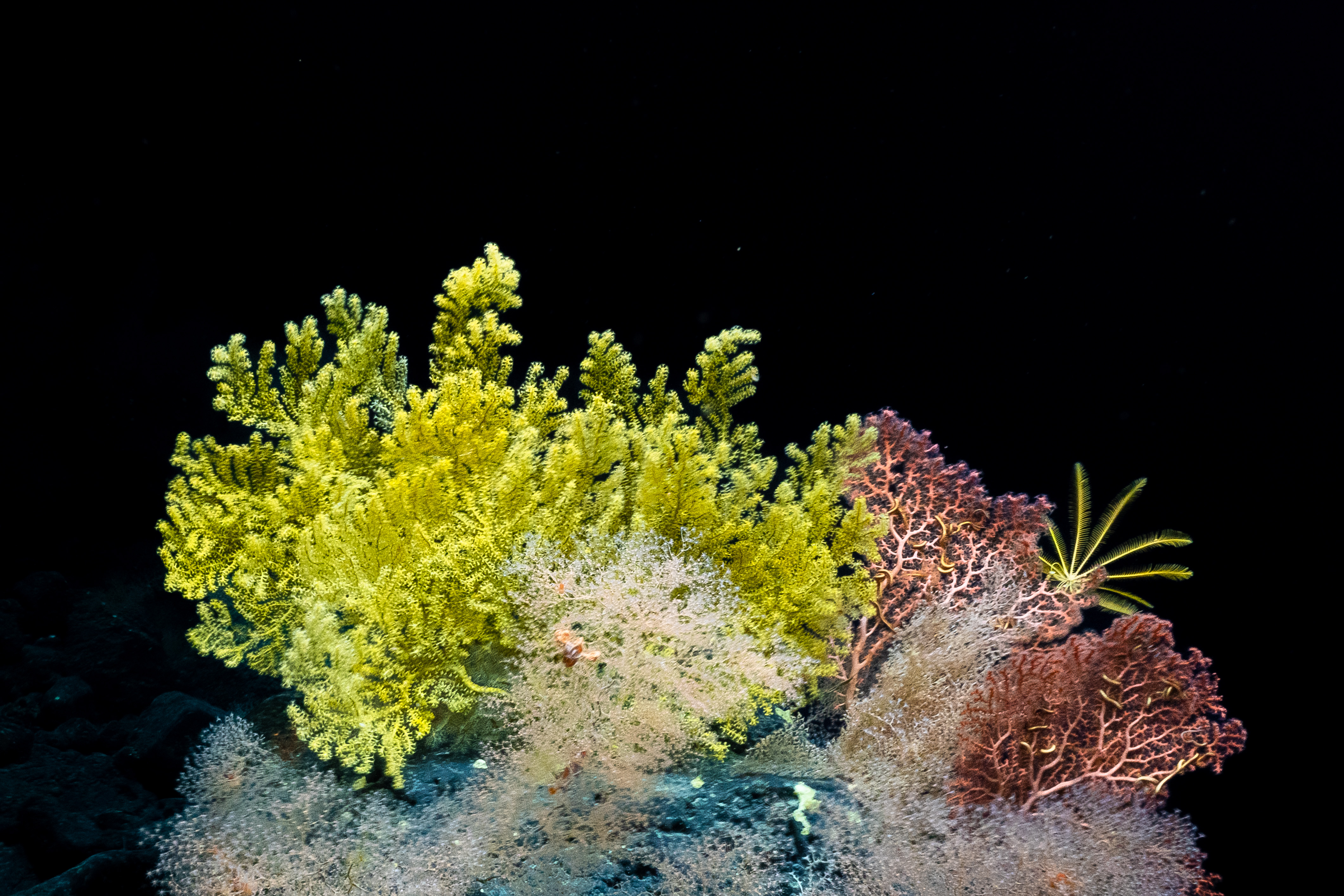
What does a biologist do on a deep-sea expedition?
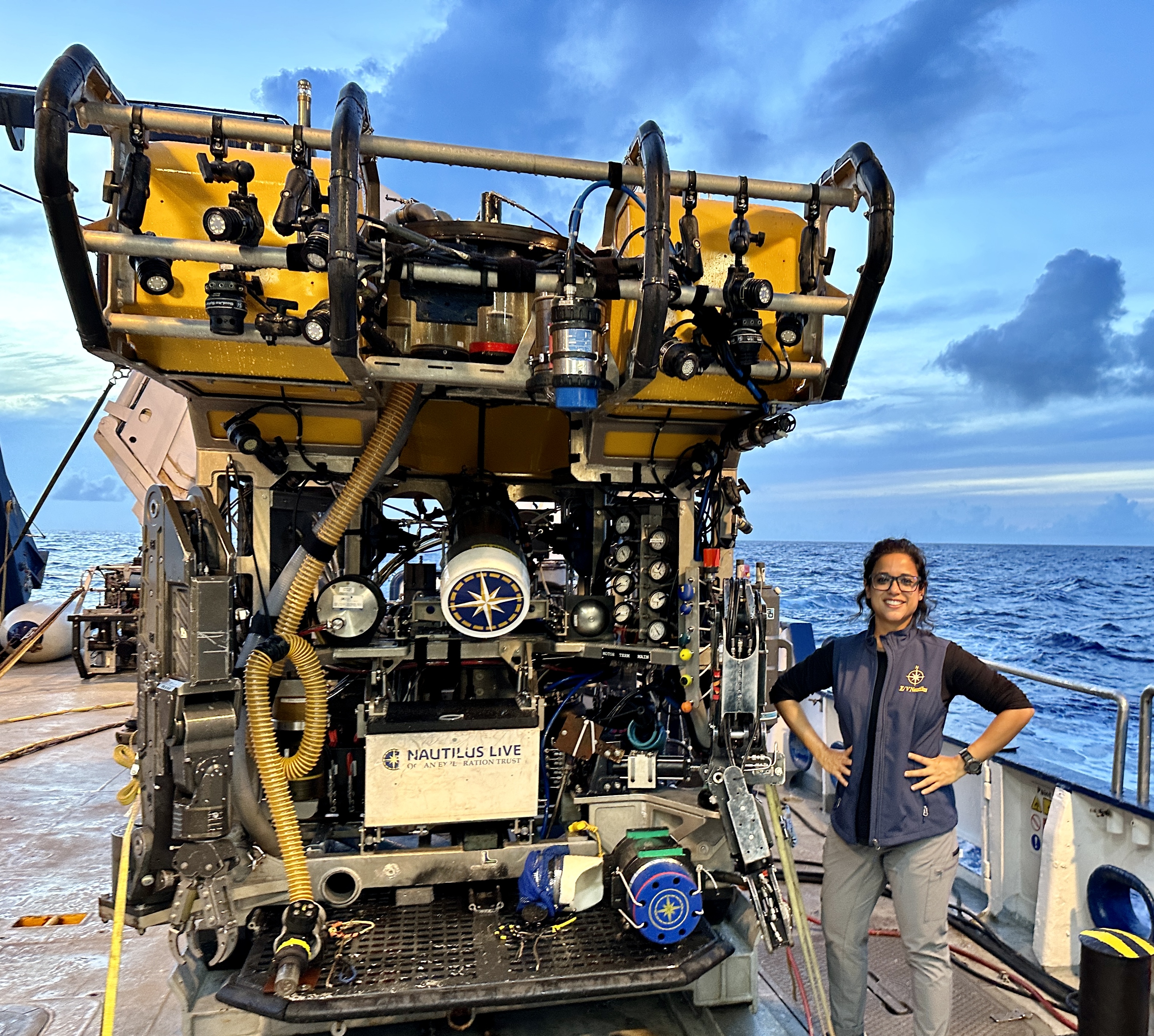
Upasana Ganguly, a PhD student in our Biology Department, served as the deep-sea biologist on the 1-28 September 2023 expedition of the research vessel E/V Nautilus exploring the undersea environment in Papahānaumokuākea Marine National Monument. Upasana has kindly provided the following summary of this expedition.
In September, this year, I joined the “Ala ʻAumoana Kai Uli” or “Path of the deep-sea traveler” in Papahānaumokuākea Marine National Monument, in the Pacific Ocean as the deep-sea biologist onboard the E/V Nautilus. This expedition was conducted by Ocean Exploration Trust to explore the unseen deep-sea habitats in the northwestern part of Papahānaumokuākea Marine National Monument (PMNM) using Remotely Operated Vehicles (ROVs). It is the largest marine protected habitat in the world, located north of Hawaiian main islands. According to the Hawaiian culture, Papahānaumokuākea is a sacred place, a realm of the gods where life evolved, and to which souls return after death.
During this month-long expedition, we conducted 12 ROV dives on underwater cultural heritage sites from the Battle of Midway and seamounts or underwater mountains to explore the deep-sea environments there. The ROVs are outfitted with high-definition cameras, sensors, sampling arms and other sampling tools. Seafloor was also mapped using acoustic sonars during the transit days to generate bathymetric maps of the seafloor in this under explored part of the Pacific Ocean and a total of almost 23,500 km2 of seafloor was mapped during this expedition.
Deep-sea Exploration
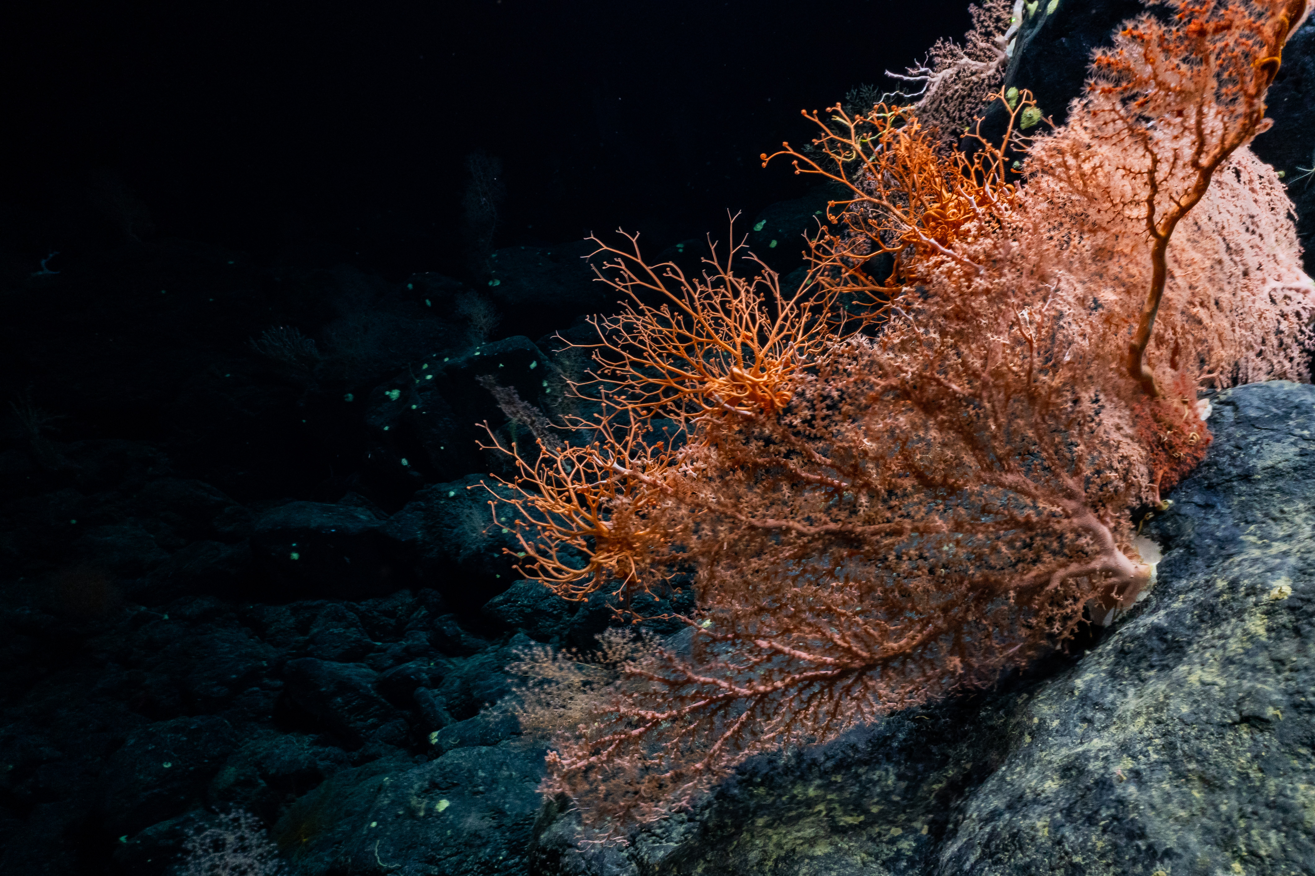
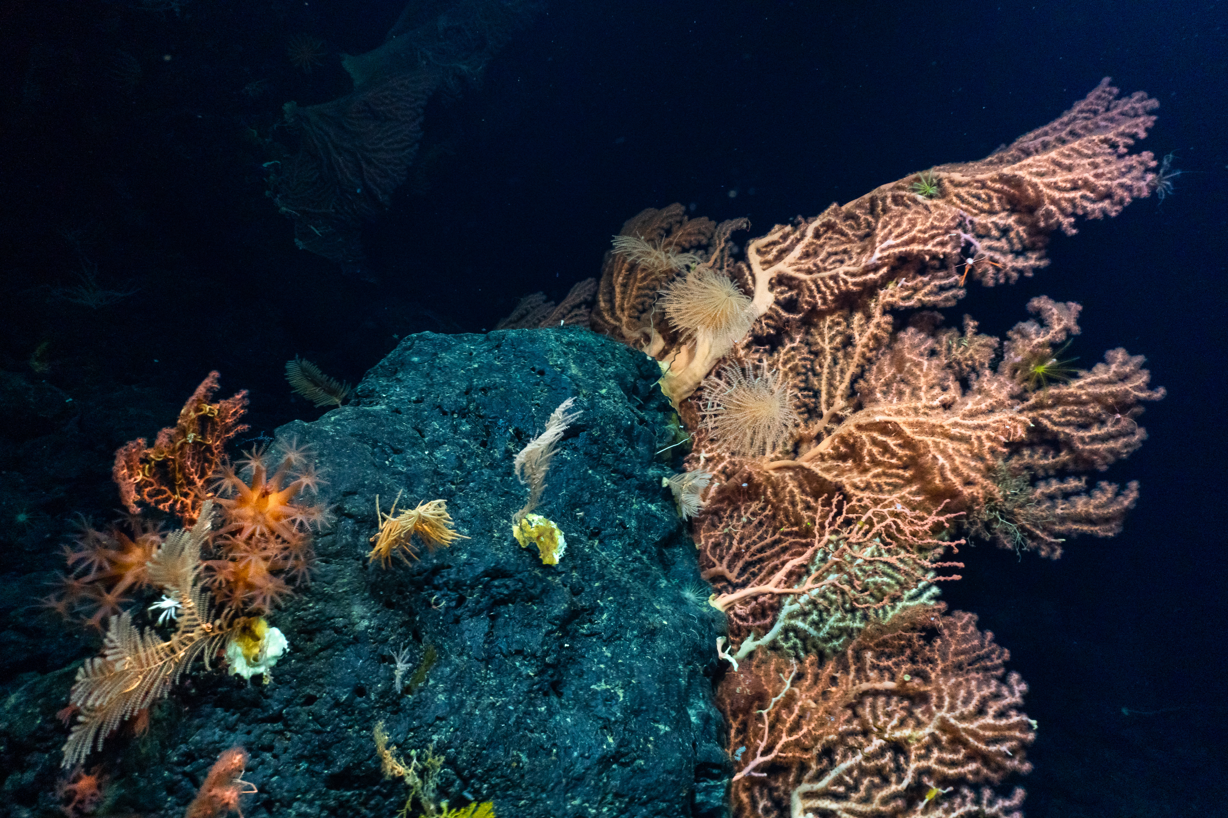
We conducted 9 ROV doves on 8 seamounts within the monuments and 6 of these were previously unexplored. All the dives were between 2000m to 1200m in depth. For years, researchers thought that these seamounts were a part of the Hawaiian range formed over the Hawaiian hotspot. However, recent studies suggest that these may have originated in the Cretaceous period over hotspots that are currently located in South Pacific Ocean.
On reaching the base of a seamount, the ROV would gradually climb along the slope recording the benthic communities and the geological formations at these depths. We explored and collected both rock samples and biological samples. The geological samples will be used to better understand the geological structure, age, volcanic history of this region. The video data from these dives and the samples that have been collected will contribute to our understanding of community composition, diversity, biogeographic connectivity, potential range expansion of taxa there. We discovered several high diversity regions including several sponge and coral gardens and observed hundreds of species of deep-sea organisms, many of which were previously unknown from this region and recorder some potentially new species as well.
Maritime Archeology
We conducted three ROV dives at depths greater than 5000m to survey 3 aircraft carriers that were sunk during the Battle of Midway in June, 1942during the World War II. We successfully completed the first visual survey of the Imperial Japanese Navy’s Akagi, a complete visual survey of Imperial Japanese Navy’s Kaga, and the first detailed views of USS Yorktown in 25 years.
All the dives were live streamed on several public domains for scientists, students, and the public to watch and also participate and communicate with the scientists onboard. This expedition achieved wide reach across the world with over millions of views and interactions on several platforms. If anyone is interested to find out more about this expedition, they can contact me or visit the NA154 Expedition web page
You can also learn more about Upasana by visiting Upasana Ganguly's France Lab web page or by visiting Upasana Ganguly's NA154 Expedition web page.
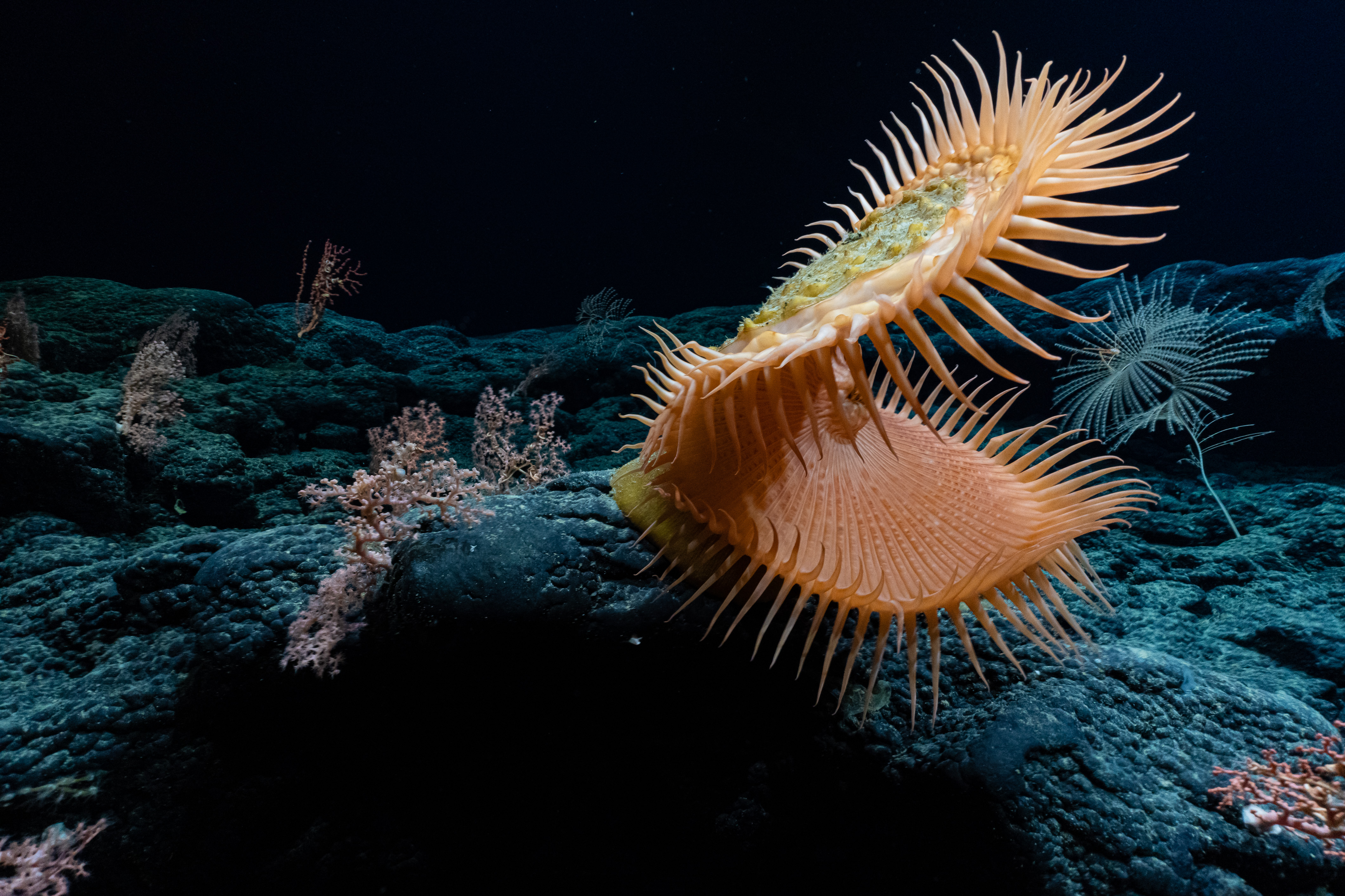
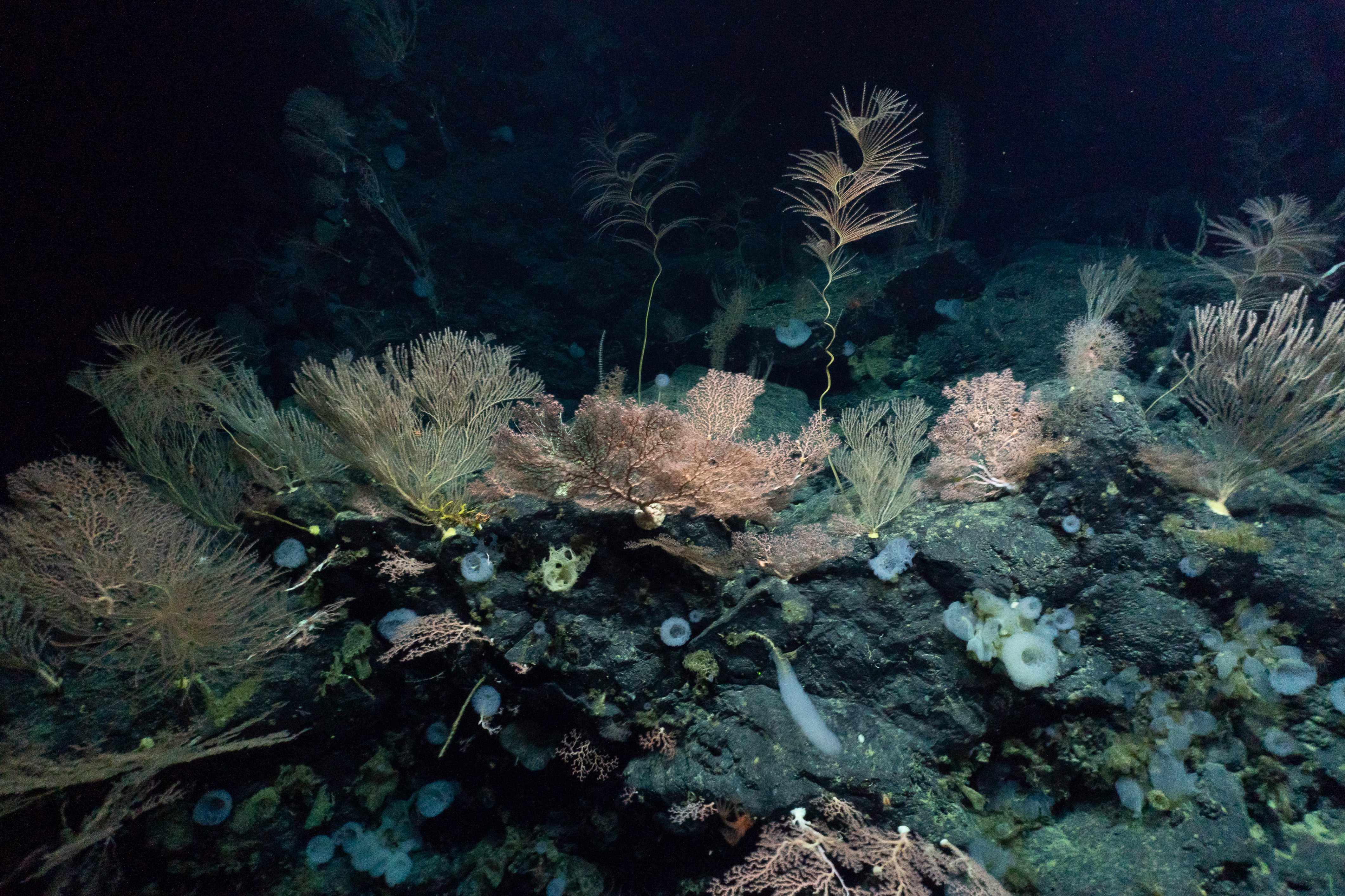
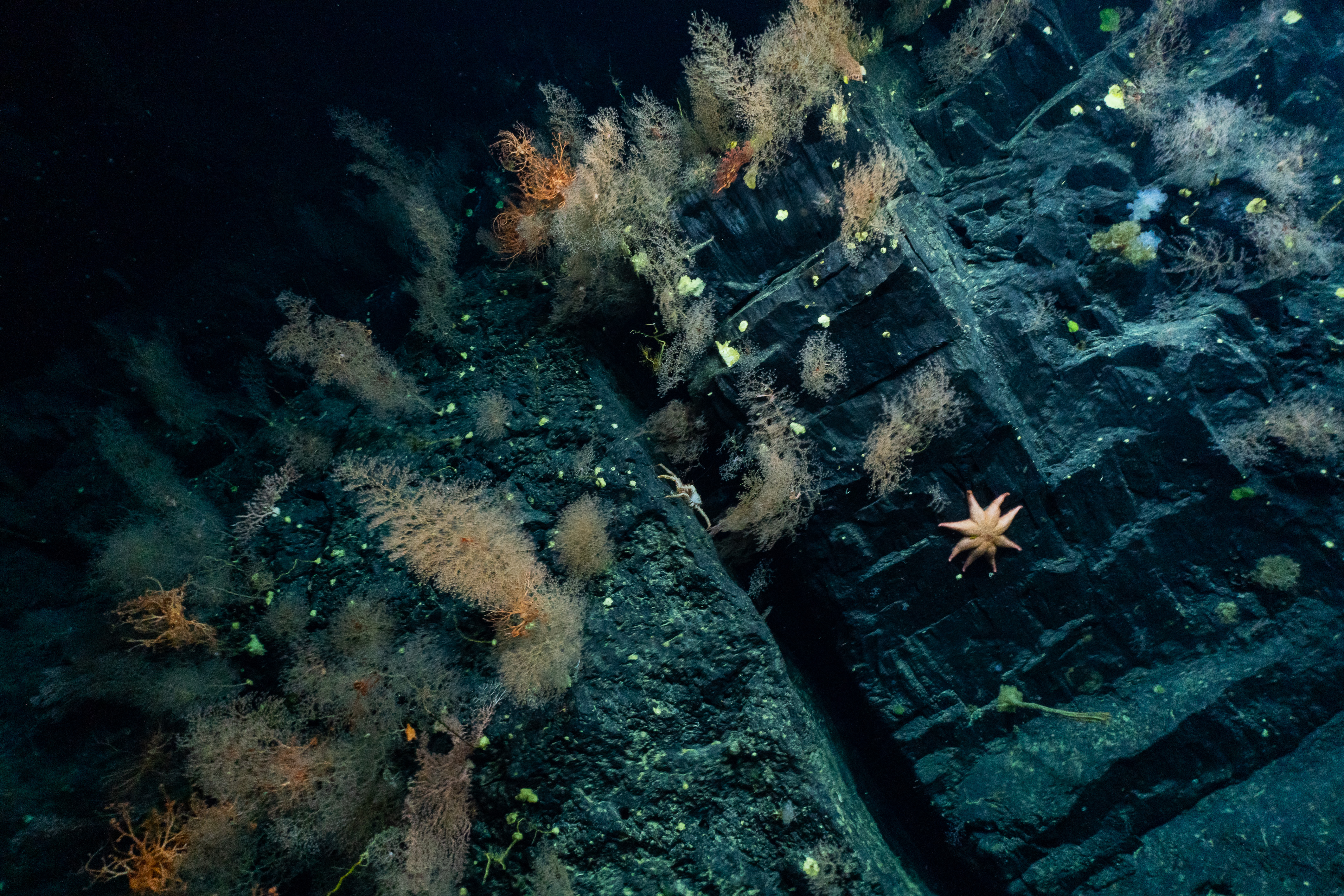
Photo credits: Ocean Exploration Trust/NOAA, except for onboard photo of Upasana Ganguly.
Biologists explore the benefits of native seed mixes for pollinations in longleaf pine habitats
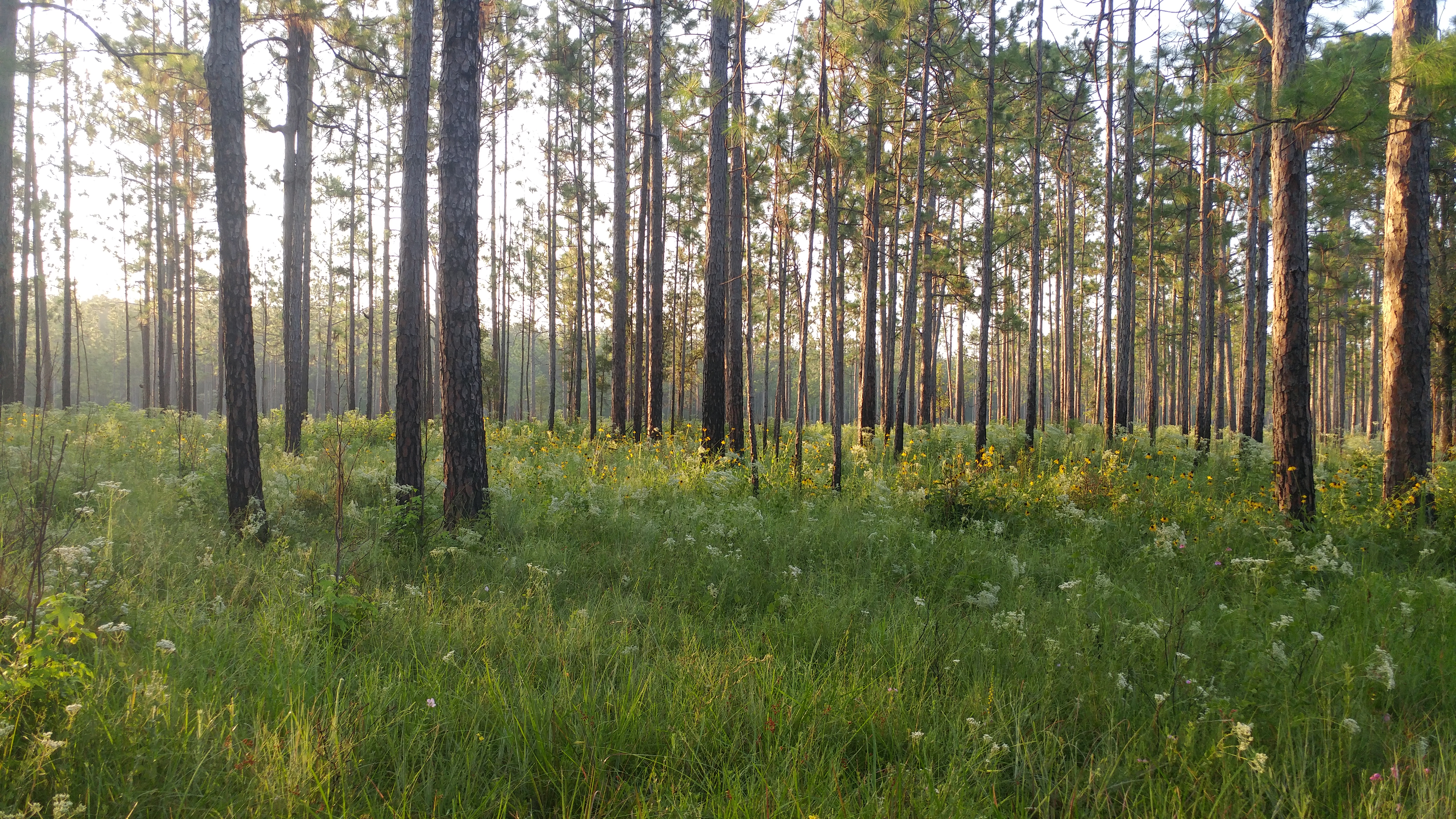
Mark Genung of our Biology Department and his graduate student Anna Espinoza have received funding from the Louisiana State Wildlife Grants Program to study the benefits of native seed mixes for pollinations in longleaf pine habitats. This $82,616 grant is funded by the US Fish and Wildlife Service and is administered by the Louisiana Department of Wildlife and Fisheries. Genung has also received additional funding of $79,454 bringing the total funding to $162,070.
This study has two goals. First, the researchers will develop native seed mixes to restore the understory of longleaf pine ecosystems after prescribed fire. They will assess restored areas in terms of how well they support native plants and pollinators, and how well they resist invasive species. Second, they will sample for Bombus variabilis, a very rare bee species being considered for listing under the Endangered Species Act. B. variabilis is a social parasite of Bombus pensylvanicus, which is among the most common bee species in Louisiana grasslands despite declining in the northern parts of its range. Therefore, B. variabilis may be more common in Louisiana grasslands than in many other parts of the country. A key part of the State Wildlife Grant program is gathering information about species that are endangered or being considered for listing as endangered.
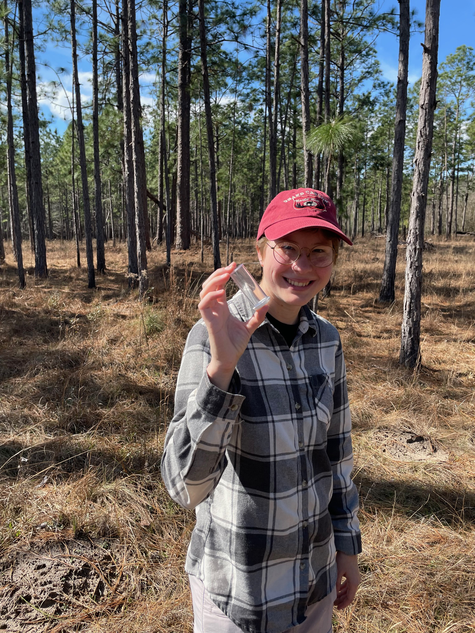
The photo above shows Anna Espinoza with a collected bee in a vial at the study site. The grant covers her summer salary.
Biologist Finds Answers to Origins of Most Diverse Fish Fauna on Earth
Recent research by Dr. James Albert, professor of ecology and evolution in our biology department, and three collaborators sought to understand the origins of the megadiversity of freshwater fish fauna in South America.
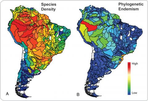
Albert his colleagues discovered that abrupt increases of species evolution coincided in time and place with major mountain uplifts and river re-arrangements.
The research by Prof. Albert and colleagues across the country was published earlier this month in the journal: Proceedings of the National Academy of Sciences. They integrated an unprecedented dataset of about 5,000 species with a newly complied, time-calibrated evolutionary tree of South American freshwater fishes - the most species-rich continental vertebrate fauna on Earth – to track the evolutionary processes associated with river and sea events over 100 million years.
“The effects of river network re-arrangements on dispersal and lineage diversification were poorly understood,” said Albert. “Our results support the hypothesis that landscape dynamics, which shaped the history of drainage basin connections, strongly affected the assembly and diversification of basin-wide fish faunas.
“Species in the Western Amazonia originated faster and persisted longer than those in other regions, substantially enhancing the exceptional diversity of aquatic organisms across the whole continent,” he added.
The study used the most complete datasets of geographic distributions and evolutionary relationships of South American fishes to date, to track the influence of the geological history on the origins, extinctions, and interchanges of these fishes over the past 100 million years.
Findings note that five abrupt shifts in diversification rates occurred during the Paleogene and Miocene periods – between 30 and 7 million years ago – in association with major landscape evolution events. These events include the formation of several mountain ranges in South America: Serra do Mar, Serra da Mantiqueira, and the Andes.
Read the full paper here: Landscape dynamics and diversification of the megadiverse South American freshwater fish fauna.
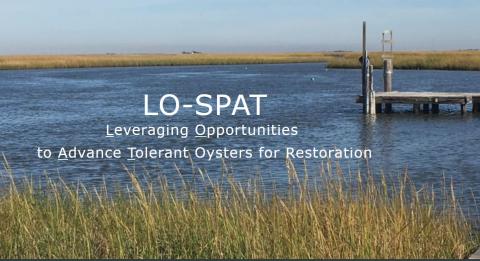
Biologist heads $14 million effort to produce more resilient oysters
Dr. Beth Stauffer, of our Biology Department, heading a $14 million, three-year research initiative to develop oyster broodstock capable of survival in low-salinity environments. Leveraging Opportunities and Strategic Partnerships to Advance Tolerant Oysters for Restoration, or LO-SPAT, is designed to help sustain populations of the shellfish and support the seafood industry. The Louisiana Department of Wildlife and Fisheries is funding the project.
Stauffer, a phytoplankton ecologist, and other UL Lafayette researchers are collaborating with scientists from the LSU AgCenter and the University of Maryland Center for Environmental Science Horn Point Laboratory. Spat-Tech, a Mississippi-based oyster aquaculture company, is the private sector partner. “The objective is to examine low-salinity tolerant populations of oysters. We’re researching how low salinity – and other environmental stressors – factor in, and identifying heritable traits that make some oysters hardier than others,” Stauffer said. The LO-SPAT team is pooling its expertise in coastal and restoration ecology, environmental monitoring, organismal and molecular biology, economics, and aquaculture and oyster husbandry. Researchers are collectively examining the entire oyster life cycle, from larvae and broodstock to juveniles that can be deployed in nurseries and, ultimately, at restored reef sites. Creating sustainable breeding operations starts with collecting wild oysters, then introducing them to stressors; the next step is using modern molecular tools to determine which oysters prove capable of growing in unfavorable conditions. “Those oysters are then bred over multiple generations through a process known as selective breeding, which allows producers to build a better oyster using their natural genetic diversity,” Stauffer explained.
It’s important work. Louisiana is one of the nation’s major oyster-producing states. Declining production, however, has created ecological and economic consequences. Increases in rainfall and flooding in Louisiana and along the Gulf Coast in recent years have introduced high amounts of freshwater into oyster habitats and reefs. That’s problematic, since the shellfish need at least some salt to live and more to grow and reproduce. Jack Montoucet, secretary of the Louisiana Department of Wildlife and Fisheries, said the LO-SPAT initiative provides “a comprehensive approach to addressing a state, regional and national problem, and we’re excited play a role in that.” “Developing an oyster that can tolerate low salinity for an extended period of time – which we don’t have now – is important to maintaining the industry as we know it. And with all of the research capabilities that exist today, we should be able to do that.” Oysters are essential to coastal ecosystem health. They filter massive volumes of water and build reefs that provide habitat for fish and other marine life. The shellfish are also vital to the economy and provide thousands of jobs. The Gulf of Mexico produces 46% of the oysters in the United States, and the regional oyster industry has an annual value of $66 million. It’s why pursuing initiatives – such as LO-SPAT – that will ensure a vibrant oyster industry has become a priority in Louisiana. Promoting sustainable ecosystems and providing habitats for commercial industries is a primary goal of the Coastal Protection and Restoration Authority’s Coastal Master Plan.
Findings generated as a result of the LO-SPAT initiative are integral to that effort. So, too, are UL Lafayette research laboratories, including at its 50-acre Ecology Center. The center has a 15,000-square-foot building that houses spaces for a broodstock facility and laboratory. Construction and operations of broodstock facilities at the Ecology Center is being overseen by a team of staff members. In addition to innovations in oyster broodstock, researchers will conduct field sampling using sensors deployed in estuaries to characterize the environments oysters are experiencing and acoustic monitoring to quantify oyster reef health.
Other key LO-SPAT researchers include Dr. Megan La Peyre, a research biologist for the U.S. Geological Survey Louisiana Fish and Wildlife Cooperative Research Unit at the LSU AgCenter; Dr. Louis Plough, an associate professor and geneticist at the University of Maryland Center for Environmental Science Horn Point Laboratory; Dr. Durga Poudel, a geosciences professor in UL Lafayette's Ray P. Authement College of Sciences; Dr. Natalia Sidorovskaia, a professor who heads UL Lafayette’s Department of Physics; and Dr. Geoffrey Stewart, an associate professor in UL Lafayette’s B.I. Moody III College of Business Administration;